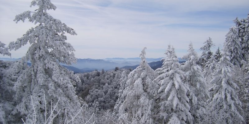
Right at the heart of the Appalachian mountain range runs one of the United States most famous mountain ridges, The Blue Ridge mountains. Running from Georgia in the south and as far north as Pennsylvania, the Blue Ridge Mountains range takes in seven states as it runs from north to south. The mountain range encompasses two of the largest state parks in eastern America, the Great Smokey Mountains State park to the south and the Shenandoah National Park to the north.
 Knowing where to start with any visit to this vast area of picture perfect mountain landscapes can be a slightly daunting thought, and that’s why in 1935 the construction of the Blue Ridge Parkway began. Providing a scenic road giving everyone the opportunity to explore the mountain peaks, vast forests and delicate wildlife whilst providing protection to environment were the main goals and fifty two years later the goal was achieved with the completion of the final section of the parkway. The parkway to this day remains the most visited property within the National Park Service and it has been that way almost every year since the mid 1940s.
 Whilst the parkway is both beautiful and at its most popular during the summer months, with the exception of fall when tens of thousands flock to see the beautiful changes in color, winter in the Blue Ridge has a very different kind of beauty and is worth the little extra effort needed when visiting. During winter lots of the parkway may be closed and therefore it is almost impossible to drive the entire length. However, large sections of the road are well maintained all year round and with a little forward planning it is possible to hop on and off to see the best sections popular in winter and therefore most likely to be cleared of snow etc.
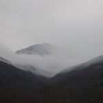
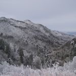
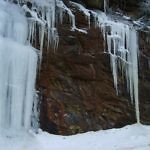
 During the winter months most of the upper reaches of the parkway go into deep freeze, this might not sound like fun but offers without doubt the most spectacular view of the mountains only available at this time of year. Frozen waterfalls, snow capped mountains, icy cold partially frozen boulder filled rivers and trees coated with the most delicate ice crystal frosting lead your eyes from one beautiful scene to the next.
 Being winter, wildlife including the Black Bears will be tucked away hibernating for the season. This does not for one moment mean the opportunity to see some of this delicate ecosystems wildlife is only for the summer months. With the trees free of leaves and the view endless the opportunities to spot bird life is like no other and the land mammals like large white tail dear and wild boar will be spotted easier less the camouflage provided by the tree tops. Still, Animals are masters of disguise and they know they are spotted easier so you may have to look a little harder and be patient.
 Whilst most of the tourist attractions along the route are closed this also means traffic is non existent and crowds are no where to be seen. Blissful peace, quiet and tranquility is what you will get along your drive and the opportunities to pull over and get out and take in the chilled mountain air are plenty. You will of course still find amenities and food stops open along the way, just expect to come off the trail a little further to reach them. With most of the large tourist type restaurants closed for winter, when you do find somewhere to stop and fill up, the chances are it will be a smaller family run establishment and you will be rewarded with a warm, friendly and unhurried welcome along with the chance to warm up on some hot soup and fresh bread or a hearty home cooked meal.
 When planing your journey some forward thinking is needed. The parkway is vast and does not have junctions around every turn, after all, it is designed to be a leisurely drive away from the traffic so junctions, traffic lights and intersections you will not find, if fact you will be hard pressed to see another road from most of it such is the great design. Winter brings its own issues as there is probably going to be many short closures due to weather.
The initial entrance in the south is just north of Cherokee in North Carolina on US-441, from there it snakes its way across the mountain peaks towards Ashville before turning north past Mount Mitchell. Clinging to the very peak of the mountain ridge between the US-19E and the US-221 the next civilization will be found when crossing the US-221 at Linville Falls. Winding further NE passing Grandfather Mountain and on towards Boone the parkway crosses US- 321 at blowing rock then continues to follow the ridge, passing the border into Virginia reaching the I-77 at Fancy Gap. Continuing east, then north east easing around the Rocky Knob recreation area the scenic parkway rejoins the route parallel to US-221 before bypassing the city of Roanoke. North of the City and passing US-460 the route continues on through the dense woodlands of northern Virginia until it reaches state highway 56. Unfortunately the section north of here is normally closed throughout winter until it reaches I-64 where the Blue Ridge parkway ends. Technically the route continues a lot further north but beyond I-64 the route becomes the Skyline Drive.
Key areas of interest, viewpoints and attractions along the Blue Ridge Parkway:
Traveling South to North.
- Maggie Valley and the Chattahoochee Ski Area – US-19
- Mt Mitchell State Park
- Linville Caverns – South of Linville falls on US 221
- Grandfather mountain – North of Linville on US-221
- Appalachian Ski Mountain – North of Blowing Rock US-321
- Chateau Morrisette Winery and Restaurant – North of US-58
- Wintergreen Resort ski area – South of I-64
Please note:
No drive through the scenic parkway should be rushed both for safety and so you don’t miss out on whats outside, in fact a lot of the parkways 469 miles have speed limits under 30 miles an hour and for very good reason, especially in winter. Vast stretches of the road are delicately perched on the side of the mountain ridges and its not the place where you want to be involved in an accident.
Please take care to pack appropriate clothing and supplies and ensure you are able to self rescue or maintain health should you need to wait for assistance for any reason.
Please do check the NPS website for road closures along the parkway before travel and don’t get caught out. If the road likes impassable ahead, do not risk it. Please adhere to closure signs and warnings, they are there for your safety. Check Live Closures here
Quick Facts:
- The parkway totals 469 miles in length.
- Passes through 2 states.
- Most visited of all the NPS Properties.
- Peak elevation 2037m ( 6684 ft ) Mt Mitchell
Nearby destinations and city’s:
- Ashville
- Boone
- Hickory
- Gatlingburg
- Pigeon Forge
- Dolly Partons – Dollywood
External Links:
